

Rosario neighborhoods
Neighborhoods in Rosario
Compare the real local destinations and the exact address. The guide preserves legal boundaries without turning them into price or safety rankings.
- Areas compared
- Nine
- Distinct geographic and daily-life decisions.
- Selected legal polygons
- Seven
- Original municipal geometry.
- Landmark-only labels
- Two
- Pichincha and Puerto Norte.
- Numeric matcher
- Excluded
- All nine areas lack comparable scoring evidence.
On this page
The short answer
This guide compares nine Rosario areas through retained municipal geometry and specific local destinations. Seven use legal neighborhood polygons. Arroyito discloses its verified Lisandro de la Torre alias. Pichincha and Puerto Norte use separate landmark points because the guide does not invent complete polygons for those labels. No comparable area rent or lifestyle series was retained. Use the distinct area pages to test a property and the household routine.
- Nine factual area guides support the home search.
- Seven legal polygons are retained.
- Two landmark points have explicit map limits.
- Rent and lifestyle scores remain unassigned.
Which area should you investigate first?
| Area | Local reference | First decision |
|---|---|---|
| Centro | Historic center | Investigate Centro when the historic civic area and verified central school or bank destinations drive your routine. Test the actual entrance and journeys. |
| Pichincha | Former railway district | Investigate Pichincha when the railway circuit and advertised workspace are useful to your routine. Confirm the actual workplace door and the property's night conditions. |
| Puerto Norte | Riverfront redevelopment | Investigate Puerto Norte when the identified riverfront redevelopment and actual building suit your routine. Compare the complete building costs before assuming the view or facilities justify them. |
| Arroyito | Lisandro de la Torre | Investigate Arroyito when the verified northern circuit anchors fit your routine. Use the Lisandro de la Torre polygon to check the actual address. |
| Fisherton | Western district | Investigate Fisherton when the actual western campus, bank or historic circuit belongs to your routine. Test the school and city journeys before committing to a home. |
| Echesortu | Legally named area | Investigate Echesortu when the actual address inside the retained legal boundaries fits your routine. Resolve the name with the ordinance rather than an older catalog description. |
| Abasto | Plaza Libertad | Investigate Abasto when the identified Plaza Libertad routine fits the household. Separate a past public event from the ordinary conditions at the actual home. |
| República de la Sexta | UNR campus area | Investigate República de la Sexta when the named UNR campus is part of your routine. Confirm current boarding and the actual home rather than assuming campus-wide suitability. |
| Alberdi | Northern district | Investigate Alberdi when the retained northern destinations and actual hospital or daily journey suit your needs. Confirm care and access separately from the circuit. |
Sources 1,
Read the map's actual evidence
Select a neighborhood to open its guide. Municipality of Rosario, Cartography, Topography and Cadastre. ODC-BY 1.0. Checked October 9, 2026. (opens in a new tab)
Municipal cartography publishes 56 polygon records under ODC-BY 1.0. The display retains all of them as city context. Seven selected guide areas use those original legal polygons. Two practical labels use separately sourced tourism landmarks. No streets or transit geometry are inferred.4,
Arroyito's tourism alias connects it with Lisandro de la Torre. Echesortu's 2022 ordinance restores its official name and defines its sides. Read Arroyito and Echesortu for those separate naming decisions.3,
Messi, Che & The Flag | Rosario Argentina 🇦🇷
The March 12, 2026 walk gives a visual reference for Centro and the central riverfront. The guide's map and local area sources cover the other eight areas.
Choose by a named destination
Use Centro for the central civic circuit and campus. Fisherton adds a western campus and historic circuit. Admission and actual journey time need their own answers.
Use Pichincha for the advertised workspace and station landmark. Puerto Norte separates the riverfront planning label from a building quote.
Use Abasto for Plaza Libertad, República de la Sexta for UNR geography and Alberdi for the northern circuit and hospital location.
Use city benchmarks only for their category purpose
| Category | Monthly asking median | Interpretation |
|---|---|---|
| One ambiente | US$251ARS 380,000 | Studio category |
| Two ambientes | US$343ARS 520,000 | Usually living space plus one bedroom |
| Three ambientes | US$429ARS 650,000 | Usually living space plus two bedrooms |
Source 20
Use Rent and Rental procedures to get a complete property offer. The category median does not establish which area is cheapest.
Use Getting around and Safety to test the journey and understand why unsupported commute or risk scores stay absent.
Questions people ask
Which Rosario neighborhood is best to live in?
Start with the household's confirmed destinations and actual property. No comparable all-area score series supports a universal winner.
How many areas does the guide compare?
Nine. Each has a distinct geographic and daily-life investigation rather than an invented numeric ranking.
Why do only seven selected areas have legal polygons?
The selected municipal records cover seven guide areas. Pichincha and Puerto Norte use separate landmarks instead of invented polygons.
What is Arroyito's official map label?
The retained tourism source connects Arroyito with Lisandro de la Torre. The map uses that municipal polygon.
Is Echesortu's current name supported by an instrument?
Ordinance 10424/2022 restores the official name and supplies boundary references.
Which area has the cheapest rent?
No comparable area rent series was retained. The guide shows city apartment-category medians separately.
Can the matcher rank the nine areas?
No. All nine remain unscored and excluded from numerical matching because comparable evidence is missing.
Does a map center describe a commute from a home?
No. A polygon centroid or tourism landmark is not an apartment entrance. Test the actual property route.
Plan your move
Get a free relocation plan for Rosario.
Answer three questions and get your tasks in order, ready to print or save.
- Answer three questions
- Get your tasks in order
- Print it or save it
Our packages are available for moves to Santiago today. For other cities, we confirm providers, requirements, and fees before you pay.
Sources and how we check them
Sources and how we check them24 sources
Every figure on this page comes from the official or primary source listed here. We checked them in . Rules and prices change, so confirm anything important with the source before you act on it.
- Rosario municipal district monitoring second round 2023, Abasto and Plaza Libertad link, observed 2026-10-09 (opens in a new tab)
- Rosario tourism official Alberdi neighborhood circuit, observed 2026-10-09 (opens in a new tab)
- Ente Turistico Rosario Arroyito and Lisandro de la Torre area, observed 2026-10-09 (opens in a new tab)
- Municipality of Rosario neighborhood geometry datastore API, observed 2026-10-09 (opens in a new tab)
- Municipality of Rosario neighborhood dataset API metadata, observed 2026-10-09 (opens in a new tab)
- Rosario tourism official historic Centro circuit, observed 2026-10-09 (opens in a new tab)
- Rosario Ordinance10424/2022 restoring Echesortu official name and boundaries, original scan, observed 2026-10-09 (opens in a new tab)
- Ente Turistico Rosario Fisherton self-guided circuit, observed 2026-10-09 (opens in a new tab)
- Rosario tourism Plaza 25 de Mayo address, observed 2026-10-09 (opens in a new tab)
- Municipality of Rosario current public hospital and health center directory, observed 2026-10-09 (opens in a new tab)
- La Maquinita Rosario operator services and address, observed 2026-10-09 (opens in a new tab)
- Banco Municipal Rosario public branch selector API, observed 2026-10-09 (opens in a new tab)
- Ente Turistico Rosario Pichincha self-guided circuit, observed 2026-10-09 (opens in a new tab)
- Rosario Pichincha special urban plan retained municipal text, observed 2026-10-09 (opens in a new tab)
- Rosario municipal October 3, 2026 Pride procession and Plaza Libertad location, observed 2026-10-09 (opens in a new tab)
- Municipality of Rosario productive districts naming Pichincha, Luis Agote, Republica de la Sexta and Martin, observed 2026-10-09 (opens in a new tab)
- Rosario tourism Barquito de Papel Puerto Norte landmark and map, observed 2026-10-09 (opens in a new tab)
- Municipality of Rosario Puerto Norte special urban plan Ordinance7892/2005, observed 2026-10-09 (opens in a new tab)
- Rosario tourism riverside park locations and connections, observed 2026-10-09 (opens in a new tab)
- CESO September 2026 Rosario rental report original PDF, observed 2026-10-09 (opens in a new tab)
- Colegio San Bartolome bilingual program and Centro and Fisherton campus addresses, observed 2026-10-09 (opens in a new tab)
- UNR CUR faculty location and district, observed 2026-10-09 (opens in a new tab)
- UNR March 2025 Estacion Siberia opening report, observed 2026-10-09 (opens in a new tab)
- BCRA USD quotation dated October 8, 2026, observed 2026-10-09 (opens in a new tab)
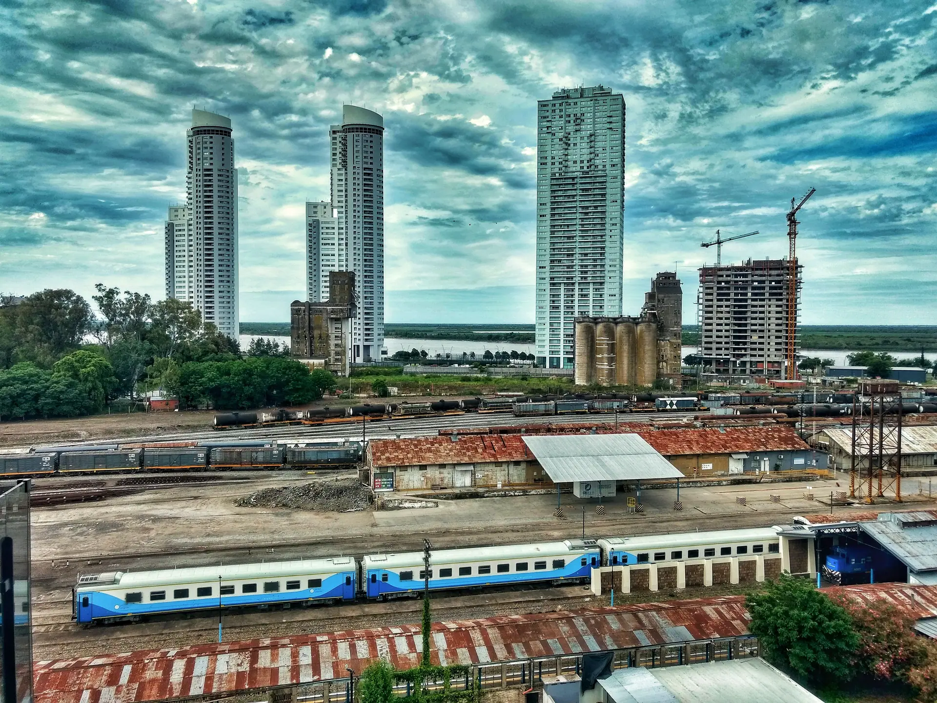
Puerto Norte towers and railway yards, photographed in 2021. The buildings do not represent the guide's citywide median rental or a current listing. Resized and converted to WebP. Hero photo by ElGuruCesar, CC BY-SA 4.0 (opens in a new tab), from Wikimedia Commons (opens in a new tab).